Thursday, September 15, 2011

Day 92- 13 Weeks On the Road

We caught the ferry in Port Kent, NY to cross Lake Champlain. It was a short trip, 9.6 miles taking a little longer than an hour but it saved us about 6 hours of travel to the top of the lake and around Rouse’s Point. It was a different sort of ferry experience than the Inside Passage. There the vehicles were in the belly and the passengers on top. Here, the vehicles were on top while us passengers rode at about water level. It was mildly disconcerting to look out the porthole and see the water just below the rim. The photo of the day is of one of the deck hands. Check out his stylish footwear. You can do anything with duct tape! Burlington was only slightly congested so we were able to get out of town in pretty good time. Then, it was “second star to the left and straight on ’til morning” or to be a little less dramatic, home over very familiar roads. We did stop in Barre for gas and lunch. I’m not sure if it was relief I was feeling when we arrived home or something a little different, maybe dread at all the stuff I have to catch up on, mail, shows to register for, several phone calls to return and of course there is the unpacking. Somehow, it’s always easier to pack than to unpack. Well, the trip of a lifetime is finally over. The partial tally stands at 92 days, 16,458 miles, 4 Provinces and 21 states visited, 77 postcards sent and 18 new refrigerator magnets to dust. People have asked what part of the trip I liked best and I have to say, I loved it all. Carl wants to go back to Arches at another time of the year and I’d have to agree. I loved Yellowstone for it’s hundreds of miles of roads which allowed much more access to the park than any other. And our 3 ½ weeks in Alaska wasn’t nearly enough. We didn’t even scratch the surface of what she has to offer. I discovered bears are more prevalent than I had previously thought but moose are more scarce in the areas we visited. I’m sure there is somewhere up there where you can’t turn a corner but you’re bumping into them. All that remains now is to unload the camper, total up the expenses for the accountant and get the rest of my images burned to DVD so I can free up some hard drive space on the laptop. Shortly, I’ll be posting a list of “Things We Learned” on our trip. I got the idea from my step mom, Adena. She and my dad traveled to Minnesota to pick up their new camper at the Scamp factory and she posted her list for friends and family to chuckle over shortly after their return. I thought it was a great idea. Now, I have to throw myself back into the business of being a photographer and a participating member of the co-op in Plymouth. I need to feel as if I’m pulling my own weight. In fact, I have a show scheduled for September 24th in Littleton I need to get my head on straight for. The following weekend will be in Sugar Hill and then it’s time for the Sandwich Fair. I hope to see you all at a venue near you!

Wednesday, September 14, 2011

Day 91- Ausable Caverns vs. Irene

After the tremendous thunder and lightening show Mother Nature put on last night which was followed up by substantial rain, it was a blessing to see the sun light trying to shine through the thick stand of pines we’re camped under. All in all, it was a pretty good night. The Red Sox beat the Blue Jays, Baltimore beat Tampa Bay and Time Wakefield finally got his 200th win after 7 previous attempts. There was a bit of a chill in the air but not enough to convince me to close up the camper window on my side last night. I just love that fresh air. It did, however, make me think about wearing slacks into the Chasm a little later in the morning. We settled up with the office where they informed Carl his admission would be free because of his military service. My fare would be reduced because we’re staying in their campground. The shorts won out over the slacks and after a short walk across the street, we found ourselves at the welcome center. Military ID’s were offered to the lady at the cash register and we both were given free access to the privately owned geological attraction that has been wowing people since 1870. And when we learned the volume of water had risen more than 60 feet during Irene’s stay in the New England area, we were not surprised to find several bridges and hundreds of feet of catwalk had been completely washed away. The gorge, part of Lake Champlain’s drainage was also littered with a variety of materials which included Styrofoam, various types and sizes of lumber, car tires and even a propane cylinder. It was relatively easy to find the high water mark by the flattened shrubbery or torn up and scarred trees. We were allowed to walk down into the Chasm along some of the platforms to within feet of twisted metal and broken off concrete. The shear power of water in a gently flowing state is often mistaken and can be very damaging so imagine more than a hundred feet of water being forced down through the narrow rocky gorge. We saw rocks from a totally different part of the chasm sitting more than 100 feet above the current level of the water which seemed peaceful enough down where they were sending off the rafts. Yes, you can walk more than two miles along the rim of the chasm or you can walk part way through and take a raft ride down over two small scale rapids and a whirl pool before hauling out on a sandy spot downstream. We chose the long walk without the raft but did accept the offered trolley ride back to the welcome center where they dropped you off at the gift shop. We had lunch there, pizza for me and a chicken patty sandwich with fries for Carl, followed by the always popular souvenir shopping, the last of the post cards to send and the last of the magnets to live the rest of their lives on my refrigerator. It never ceases to amaze how many photos I take during a day like today. The warm sunshine was broken with light clouds, the walk was pleasant and the scenery was geologically breathtaking. I can’t get over how many layers of sedimentary rock make up the steep sided gorge, some more than a foot thick while others are a mere inch or two. We got an up close and personal look at the Rainbow Falls at the head of the Chasm where two hydroelectric buildings still provide power to the grid. We also saw a large eroded area near the bridge. All in all it was a great few hours and even though I’ve often said there is no such things as bad pizza, I’m not sure I’d rush over there to have another piece any time soon. And here is something else to consider. This was another place where there was no signage offering military personnel free admission. Over the 13 plus weeks of our trip, we are now in the habit of bringing out those cards as our preferred form of identification. Carl’s military service along with so many others shouldn’t be reduced to having to ask for reduced admission. There should be signs everywhere proudly proclaiming servicemen are welcome with all thanks. Everyone seems to fly a flag and think that’s enough.

Tuesday, September 13, 2011

Day 90- I Love NY

Or at least I love the part of NY that we traveled through today. We left Dickson City, PA late. When Carl opened the door this morning to fill the generator, he couldn’t even see the end of the parking lot the fog was so thick. I stayed in bed with another headache over my left eye but by 9:00, I was feeling really guilty for holding up our departure. I had scheduled 369 miles to travel today and knew it would be a long day. By 9:30, we were on the road, Rte 81 North which we would stay on until Watertown, NY. The further north we traveled, the more I noticed the reds of the swamp maples popping out. It would have been spectacular if the sun had been out. As it was, we were traveling under this massive dark cloud. After turning onto Rte 3 East, storm damage from Irene became evident, roads and culverts washed out as well as lots of mud encrusted foliage way above the water line of the rivers and streams we were crossing. We traveled through some of the places I’d only ever heard about, Tupper Lake, Saranac Lake and even a little town called Fine. At one point we entered Mexico which was kind of cool but later when we hit Peru, I knew we hadn’t actually turned south. Apple trees became more prevalent and signs showed us entering and leaving the Adirondack State Park several times. For a while, we traveled along the Saranac River, a beautiful and fully flowing body of water. I ’m not sure what it normally looks like. From Rte 3, the AAA trip tik sent us on back roads, a mile to the right, 3 miles to the left and so on for about 20 miles until we rounded a corner and found ourselves looking at Rte 9. I made an educated guess to turn left. Yesterday, when I was at the AAA website I plugged in the address of the campground and was informed that no such address could be found so I chose an address they suggested. My hunch proved right. We found Ausable Chasm about ¾ mile down the road and the campground appeared shortly thereafter. I’m excited to be here. As we passed over the Chasm, I looked to the right and saw 3 waterfalls. The office was closed when we arrived but they had put out a note with our site assignment. We’ll check in with them in the morning . All of the roads in the campground are named after trees. We’re in Ash 12. It’s a drive through site and although there is no wi-fi, Carl has 13 TV stations. We decided not to unhook tonight because Carl is sore and tired, I’m okay with that. My head is still pounding. I helped him with the electric and then went inside to put out the slider while he hooked up the water. Then I went outside to inform him of an overly friendly chipmunk but he wasn’t in our site. Sure enough, he’s over at the neighbor’s who is hanging Christmas lights in their site, by the way. He’s such a social butterfly.

Monday, September 12, 2011

Day 89- On The Road One More Time , September 12, 201

I think we lulled ourselves into a state of disbelief where Tropical Storm Lee was concerned. Today, we left Carlisle, which was relatively untouched, and headed for Hershey. We knew the park had had some washout issues and were uncertain what we might find. What we found was muddy high water marks more than 6 feet up on trees. Whole fields were flattened and a section of roadway will need to be rebuilt about ¼ mile long. The ground and asphalt was gone on either side of the guardrail. I can’t figure out what was keeping the guardrail there. In other places, you could see debris hanging from branches 4 feet above the ground, road signs were flattened over from the force of the water and large areas of roadside where covered with mud and trees. When we arrived at Chocolate World, the signage indicated the amusement park and the sports complex was closed until further notice and the parking area in front of the Experience Center had only one bus and perhaps 50 cars total. I haven’t a clue how many of those cars belonged to staff members. Once inside the building, a gentleman handed us a map of the building and explained our options. We decided to take the free factory tour and add two paid additional experiences, the Chocolate Tasting Seminar and the Build Your Own Candy Bar. We could have added a trolley tour of downtown, a create your own dessert and the 3-D extravaganza. The factory tour was a mock up of the real thing. They changed this around in the late 80’s because so many people were touring the plant, they couldn’t get anything done. Then we went to the Chocolate Tasting Seminar and were the only two people in the room. There were five pieces to try, starting with milk chocolate, the lowest percentage of Cacao all the way up to a 45% square. We were invited to snap in half, smell and take a nibble to melt on our tongues. The “Guest Lecturer” encouraged us to figure out what the finish of the candy was, similar to a wine tasting. I explained to her I was a dismal failure in the wine tasting experience, but, I could pick up some of the after notes like coffee, cinnamon, fruit and caramel depending on a variety of reasons. I asked about the higher percentage of cacao and she said Hershey makes a Sharffen Berger Bittersweet Chocolate that is 70% cacao. They gave me the last little sample square they had but I haven’t tried it yet. After I share it with Carl, I suspect I’ll be unable to afford the bar. This seminar was entertaining and I did learn to just melt the chocolate on your tongue instead of biting and chewing. I also learned the average milk chocolate candy bar takes 10 days to make ( from Cacao nib to bar ) while the Sharffen Berger sample I haven’t eaten yet takes 45 days. I have a new respect for the common candy bar. The last thing we did was to make our own candy bar. We had to put on aprons, hair nets and sanitize our hands before putting on a plastic glove over my wedding ring. Carl even had to cover his beard. Then we entered the mini-factory and chose our base chocolate, milk or white. They were out of dark chocolate today, bummer! That's the one I would have chosen because it's loaded with antioxidants which are good for you. Then we could choose 3 ingredients to add to our bar. I chose raspberry bits, pretzel bits and butter toffee crunch bits. The other three ingredients were crisped rice, chocolate bits and almond slivers. We watched as each ingredient was added and then followed our bars through the robing process (pouring milk chocolate all over the bar ) until we lost sight of them in the cooling tunnel. The bars would spend 6 minutes in this cooling chamber which would give us time to design our own wrapper in the production studio. It was a touch screen process which allowed us to choose colors, logos, wording and other additives. The board on the wall notified us when our bars were leaving the cooling tunnel and heading to the boxing machine. This was a fun thing to do although I have to admit I would have liked different ingredient options from what they offered. I would have chosen to add coconut or mint chips to my bar with almond slivers on top. There was a space at the end for us to give them suggestions for other ingredients to be considered. The computer also compiled statistics from all the people who have built candy bars. My bar was completely unique. No other person has chosen those exact ingredients. I don’t know if this is good or bad. I spent some time in the souvenir shop and then we hit the camper in the parking lot for lunch. It was the fastest two hours I’ve spent in a while. We were supposed to head to the Crystal Cave in Kutztown but the lady at the souvenir concession thought they were closed due to the flooding so we passed and headed to our “campsite” for the night. When I built the trip tik for this alternate trip, I may have put in the wrong information and had I not read ahead we would have driven 25 miles north to turn around and drive 23 miles south. It saves us time and gas. Our generator is puttering away while Carl is watching TV. And me, well you know what I’ve been doing. You’re gonna miss these daily blogs when this journey is over, aren’t you?

Sunday, September 11, 2011

Day 88- 10 Years Later , September 11, 2011

There are few days in history when events are such that everyone remembers exactly where they were or what they were doing when they heard the news. Today was a day for retrospection, the phrase , “Where were you when…” kept coming to mind. Days like the invasion of Pearl Harbor, the assassination of President Kennedy, the first man in space, the first landing on the moon, the death of Elvis Presley and the attacks on the World Trade Center are just a few that come to mind for me. Both Carl and I sat before the television in the camper watching the events unfold on this 10th anniversary much as I did on that horrific and eventful day. Only today was a much more believable scenario. Ten years ago, I sat stunned, thinking it must be some horrible mechanical accident, unbelieving that anyone, in their right mind, could dream up and put action such events. The world is a much different place today and things can never be the same as they were. After careful debate, our plan has also changed once more. This latest change will see us home in a few days. The new plan is to leave Western Village RV Park on Monday morning and head for Hershey, PA to spend a couple of chocolate filled hours learning about the stuff that fills my head with dietary suicidal notions. I hope to learn the truth about chocolate actually being good for you. Afterwards, we’ll visit the Crystal Cave in Kutztown, PA for a tour of the underground limestone formations. From there, we’ll head north and spend the night in Dickson City, PA at the local Wal-Mart. On Tuesday, we’ll continue north into New York, driving up through The Adirondacks to end at Ausable Chasms campground for the evening. Wednesday will be spent in and around the geologic wonders of the Chasm. I’ve heard about it but never visited so I understand we’re in for a treat if the weather’s good. We’ll spend another night at the campground and head for the Lake Champlain Ferry at Fort Kent, NY on Thursday morning. If all goes as planned, our arrival into Burlington will leave us with a 3 hour trip home. Okay, so that’s the plan. What I can’t figure into this travel plan is any Irene or Lee damage remaining in Vermont. We’ll know when we get there. The good news in all this is when we get to Vermont detours, we know the roads they might switch us to, unlike in Lancaster County, PA. This afternoon, we went to fill up the gas tank and grab the last few groceries needed for the last of our trip. Carl swung by the cinema and I discovered we had about 5 minutes before the next showing of “Apollo 18” began. Believe me when I tell you this is one of the worst movies I’ve seen in a long time, it’s a Blair Witch Project rip off and it wasn’t worth the $13.50 we paid to see it. And don’t even get me started on the popcorn and coke that cost $12.25. The tally stands at 3 movies viewed over the 12 weeks we’ve been traveling. I guess it’s true what they say, “two out of three ain’t bad”.

Saturday, September 10, 2011

Day 87- And Then It Rained Again!

There was blue sky and brilliant sunshine when we woke this morning. It was good to see. The rivers are dropping and people are beginning the drying out process. There are threats of showers later and I suspect they will appear about 3:00 when we’re packing. Most craft show vendors know what I’m talking about. The customer traffic was slow today but a man came over to see if I’d take his photo. He said he was the director so Carl and I assumed he meant the chapter director. 10 photos later, I found out he wanted the picture of himself for some magazine. He asked me to burn the images to a DVD so he can send it to his people which I did. He seemed happy. An hour or two later, I asked the Vendor Coordinator, Al, and discovered Mike is the director of the entire GWRRA and not just the PA chapter. The photo I took will most likely end up in every Gold Wing magazine published for several years because Mike writes a welcome or editorial piece each month. Here’s keeping my fingers crossed. I could certainly use that kind of exposure and it may even convince me to apply for the photographer’s pass in Denali for another year. I took one other set of photos today but this one made me kind of melancholy. The man needed to sell his bike because his legs can no longer deal with the weight. The wife wanted to buy him a three wheeled motorcycle called a trike but the man doesn’t want to admit he’s having trouble, yet. So, the wife asked me to take a photo of her husband and his bike before he has to give it up. I know a bit about how he must feel. My knees aren’t as good as they used to be and my love, riding horses, would probably kill me if I had a steady diet of it. I kept watch on the skies as the afternoon wore on but the big dark clouds snuck up on me from behind. We did manage to get everything packed into the truck and about half way back to the RV Park before the first drops fell. Then, it sort of stopped so we drove on over to the dump station to empty our tanks. It was then the sky opened it’s dump valve and we got drenched. About 20 minutes later, the rain let up enough so we could back into our site. And 20 minutes after that, two muddy and very wet people climbed into the camper for the night. The photo for today's post is a view from our truck during the cloudburst. All in all, I’d have to say our trip to the PA GWRRA Rally was a success. People had difficulty getting there because of road closures but once there, everyone had a good time. Someone pointed out the motto of the Gold Wing Riders, “Fun, Safety, Knowledge” and they like to put it in that order.

Friday, September 9, 2011

Day 86- Finally, A Dry Spot

My original plan was to be on site at 8:00 AM but that didn’t happen. It wasn’t that bad, though. We were ready to chat with potential customers by 9:30AM, only a half hour behind schedule. There aren’t many people around and the few we’ve talked to have come in their cars because it just isn’t any fun getting drenched on a motorcycle. Each person I talk with is informed I’m here to take photos of “Boy, Bikes and Babes” as Carl likes to put it. Today, I got several maybes and lots of firm no’s but there were also a couple of “I’ll talk it over with the boss” which is my personal favorite. We did a several sales and all in all considered it a pretty good day even though I didn’t make a sale after noon. The weather forecast for tomorrow is much dryer so I’ll be hanging all of my hopes on Saturday. We’ve decided to stay the night in the vendor lot. Carl is leery about leaving the inventory since it doesn’t seem as if the Hotel has any security patrolling the grounds. And, each year the rally sponsors an ice cream social and we’ve always been given tickets to the event but never taken the host club up on their offer. That is, until tonight. The ice cream was great and afterwards, several of the chapters performed in the talent show. The theme for this year is Hillbilly based and some of the costumes were downright hilarious while others were tastefully authentic. Before we retired for the night, we refilled the generator and checked on my photos in the tent. Everything looked just fine. And we have a new neighbor who sells pop up campers which tow easily behind motorcycles. It has quite a bit of storage room under the platform and when folded out offers a double bed. It takes about three minutes to open up or close. The way I figure, if you're traveling on a motorcycle, you already had to pack light anyway. This just gives you sleeping options.

Thursday, September 8, 2011

Day 85- On To The Rally

It continued to rain most of the day and although the rally officially started at noon, the only people we saw today were other vendors and the vendor coordinator, Al, who has been great. There was finally a break around 2:00 so we jumped at the chance to get the tent up, tables and racks inside and the sides zipped on and down before it began to pour once more. We timed it just about right. The water problem is enhanced because the Hotel Carlisle has a large amount of water in their cellar with a sump pump working round the clock. The water level Thursday morning was more than 10 inches deep but when Carl looked today, it had dropped considerably. Now, we don’t care one way or the other about the water in the hotel’s basement but the discharge for the sump pump has created a problem in the vendor area. The “Carlisle River” , as we have dubbed the stream, travels more than 100 feet from the end of the discharge pipe into the parking lot where the vendors are set up. Our original site is under water and the inches deep stream cuts the pavement in half diagonally. Carl looked for a culvert or sewer drain that might be block but didn’t find anything. The ground at the end of the parking area is saturated to the point the water is collecting into a lovely little pond. This is another day I haven’t taken any photos so I’m going to have to look really hard for a subject or two tomorrow. Carl suggested we go out for supper and our choice was “Bob Evans” . Neither Carl nor I have ever eaten there before. I had a turkey dinner and Carl had country fried steak. Both were served with lots of real mashed potatoes and gravy plus two generous and delicious home made rolls, warm from the oven. Well, okay, it might have been the microwave. Both of our meals were mighty tasty. We’ve also heard their breakfast are also tasty so maybe before we head out of the area, we’ll give them a try. When we returned to the campground, the original plan was to back in, remained hooked up and settle in for the night but Carl decided it didn’t take us all that long to unhook and rehook. What took the time was leveling the trailer. We had to put the driver’s side or left side wheels up on blocking more than 4 inches to get anywhere near level from side to side. The site is off that much. Then I listened to the Red Sox get their collective butts handed to them by Toronto. I went to bed, still a fan, but wondering why most years, the team fades at the most crucial part of the season. In the words of Yul Brenner in “The King And I” , ’tis a puzzlement!

Wednesday, September 7, 2011

Day 84- Flood Watch

Sure enough, there are flood watches and warnings in effect for more than a dozen counties. The Susquehanna River and several tributaries are already at flood stage. We’re in Cumberland County which is laced with rivers and streams. In fact, so are York and Lancaster counties right next door to us. The kicker is the weather is so lousy, we don’t want to go set up today but if we don’t we may have to squeeze in tomorrow morning. So, we’re here in the campground peeking out the windows at all the sites around us, empty and flooded with massive puddles. During the day, we went over to the Hotel Carlisle, but didn’t set up. Probably a really good thing because it’s been really raining hard. The TV is full of NOAA emergency flood warnings, cancellations and they’ve even sheltered the children in school instead of releasing them and sending them home. Now, doesn’t that sound dire? To me, it sounds safer than trying to deliver them over flooded back road with questionable bridges. And believe me when I tell you there are a ton of bridges, concrete and covered in the counties in question. Also having driven some of these roads in the past week, I can attest to how close the creeks and rivers are in spots. We hit the Wal-Mart on our way back to the campground to get a couple of things we were out of and there was the Red Box once more. Tonight’s entertainment was a 2010 released movie called The Conspirator. It was based on the trial of Mary Surratt, one of the alleged conspirators, found guilty of the plot to assassinate President Lincoln, and hung by a military tribunal. I’m not guilty of spoiling anything to this point because it is a matter of historical record but the trial raised many questions and I highly recommend the movie. Now, I’m listening to the Red Sox against the Blue Jays. Wakefield goes for his 7th attempt to win his 200th game. Holding my breath and keeping my fingers crossed here.

Tuesday, September 6, 2011

Day 83- Rain, Rain, Go Away!

Our trip back to Carlisle can be summed up in just one word, “RAIN”. It was pouring when we left Easton and it was pouring when we arrived back at the camper. There are large amounts of standing water everywhere and the news and weather are filled with warnings for flooding. The rain from Lee is heavy and stalled over the area which doesn’t bode well for our outdoors rally at the Hotel Carlisle. Set up is for Wednesday but I’m less than enthused about the prospect of exposing my work to the dampness. Rain and paper based products do not mix well. Granted, we have a great heavy vinyl tent and my work is, for the most part, in plastic sleeves but the dampness permeates everything including my bones. And, on top of the whole dampness thing, I can’t imagine the participants, Honda Gold Wing owners, really enjoying this kind of weather. We rented a couple of movies from the Red Box at Wal-Mart, had supper and then settled in for the night. I’d like to say we were lulled to sleep with the pitter patter of the rain drops on our roof but that isn’t the case. We are under an oak tree and the heavy downpours have done a number on the acorns falling on our roof. And you know the weather is depressing when I didn't grab even one photo to post with the blog today.

Monday, September 5, 2011

Day 82- Travel Back To PA

I was only 25 miles down the road when I remembered the first thing left behind. I have shirts embroidered with my company name as well as our first names on them. I meant to grab a couple of them but they will spend the next couple of weeks in the closet in NH. I was further down the road by several hours when I remembered the other things I left in NH, my rubber boots, a spare pair of heavy socks and the umbrella. Does it sound like I was planning on bad weather? Well, you’re right. I’ve heard what could be a lousy batch of weather over the few days we’re at the Honda Gold Wing Rally. In fact, today, we’ve driven in and out of rain for more than 300 miles. I drove about 150 of those miles. As we’re paying our $1.00 toll to pass from New Jersey to Pennsylvania, I notice a very long line of utility trucks passing through one of the booths. The signage on the door read North Houston Pole Line, Texas. There were more than 50 trucks, bucket trucks, pickups, equipment haulers and even trucks with lots of ladders. I suspect they were returning to Texas after helping get the power back on where Irene had passed through. We’ve stopped for the night at the Towne Place Suites by Marriott in Easton, PA. The room was very reasonably priced and quite nice. And, there’s a Sonic at the end of the driveway. Now, don’t laugh when I tell you we drove to Sonic because it’s a Drive-In and kind of cool. You pull up to a flashy board, make your decision and then push the button. A voice asks for your choices and then they bring the food to the car. We could have eaten it right there but decided to return to our room. Now, it’s relaxation time. Weather permitting, we’ll be going to Hershey tomorrow. I am told the whole place smells good enough to eat.

Sunday, September 4, 2011

Day 81- More Of The Same

Now, the work begins. I have to decide what to take to PA with us for the show. It’s been so long since we’ve packed for a show, I want to make sure we have everything we need, including enough paper and ink since I’m taking the printer with me for this one. And, it’s really muggy out so I don’t feel like moving. The only way it could be worse is if we were at a local show today in all this humidity. When I opened the door to the studio, I almost screamed. There were bugs and cob webs everywhere. I have to send in my exterminator before I can work there. Okay, so the bugs were mostly flies but where there are cob webs, there are spiders. I heard this trivia fact a while ago which says you are never more than 6 feet from a spider at any time. If that’s true, I’ll be lifting my feet from the floor quite a bit. It took quite a while before I made the decision on which photos to take and while I was repacking the blue plastic covered bucket, Carl put the racks, tables and tent into the truck. It took even more time to load everything else because my glasses kept fogging up and everything in the studio had steamed up too. The air conditioner in the studio works really well but we had to leave the door open for the loading process. By the time we were finished, the sky was black as night and we could hear the distant rumbling of what promised to be a whopper of a storm. And even before it started raining, we were drenched with sweat. I hit the shower which felt really good and spent another hour trying to figure out how to get a downloaded template from Avery to work on Microsoft Word. Avery uses the Word platform and I am unfamiliar with the program. I’d prefer to use Works which I’ve used for years. No go on the application so I asked Carl to come upstairs to get the printer which was the very last thing to be packed. I have one last thing to get tomorrow, ink. The photo was taken by my step-mom, Adena, while we were in WA state.

Saturday, September 3, 2011

Day 80- Finally, No Techno Glitches

I managed to recreate a bunch of stuff so I could, at least, print some note cards and photo cards. It would have been the perfect opportunity to redesign my business card but, hey, I like the one I’ve got. We’ve had a couple of great conversations while we’ve been back with our daughter and Mom. They both hid health issues while we were away. Mom helped put together a new PA boxed set of note cards and I printed some of the best snapshots we took on our trip, grizzles, big mountains, cute fawns and an amazing shot of a monarch butterfly on a sunflower head. They look great. It was a productive day and best of all, the Red Sox won as well.

Friday, September 2, 2011

Day 79- Work, Work, Work

Well, that was the plan right up to the point in time where I discovered my desk top computer had a heart attack and a stroke while I was away. I tried every trick I knew to get it to respond to my key strokes but nothing I did made any difference. I even tried calling the shop who built it for me years ago. They were either all off for the long holiday weekend or some one forgot to shift the phone from fax mode to talk mode. I got that irritating squeal in my ear each time I called the number. So, I spent the better part of the day finding software install disks for my printer, card design and photo printing. Then I held my breath because they are all designed for Windows XP and my laptop is Windows 7. Have I mentioned how much I don’t like this platform? Sure enough, there were glitches left and right. When I tell Print Master to print a designed note card, instead of getting the 5 sheets I ask for, it decides to print 25. And my photo printing software will only print single pages even when I tell it I want 3 of the same. At one point today, I needed a serious technology break. Even my clothes dryer and I couldn’t see eye to eye for a while. I had to redesign my business cards, thank you pages and every note card I wanted to print. I needed labels for the backs of photos protecting my copyright and I’m sure by tomorrow, I will run out of ink because Carl had to make a trip to Staples because I was almost out of envelopes and matte paper card stock. It hasn’t been a very good day. I only hope tomorrow will be better. I need to finish printing everything and then get out into the studio to get things in order. We’ll pack up the truck on Sunday and head back on the road Monday morning. Carl was able to get the generator in to the repair shop and while they weren’t able to repair what’s wrong, they were able to tell him what the problem was. We just worked it too hard. It needed a deep cleaning and some TLC. So, Carl left it there for a much needed “spa treatment” and he purchased the companion model to the one we have. We’ll now be able to connect the two of them and end up with more electricity than two singles alone. Don’t ask me how it works, I just know it does.

Thursday, September 1, 2011

Day 78- A Quick Trip Home

It’s weird that two people should be so in tune as to come up with the same idea at about the same time. It doesn’t matter who came up with the plan. What matters is we both thought about heading home a day early. So we did. By 9:30, breakfast was eaten, we’d collected the dirty clothes and recyclables, done up the dirty dishes and taken out the trash. And then we headed north. We stopped for gas twice, a pit stop or 4 and a quick lunch on the go. By the time we hit Northampton, MA, it was time to stop and eat supper and then it was back on the road. We did hit a bit of traffic around the Waterford and Hartford, CT interchanges and some construction on the Rte 91 corridor but we encounter few serious delays and arrived home by 9:30 PM. In some ways, it doesn’t seem as if we’ve been away. Not much has changed. Tomorrow, we’ll see about the generator, I’ll work on some photos to be printed and matted, we’ll load up the show tent, racks, tables and everything else I’ll need to do a show for the Honda Gold Wing Road Riders Rally at the Hotel Carlisle from Sept7-10th. Not sure what we’ll be doing after that. I have to be back to do the Littleton Art Show on September 24th… I know I’ll see some of you there.

Wednesday, August 31, 2011

Day 77- 11 Weeks On The Road

What a great day we had, none of the frustration of the day before. We drove to the Lancaster County Visitor’s center and talked with a wonderful guy who knew just what we needed. He even showed us some of the photos he’s taken on his i phone. We chose to drive the 5th and final tour, the Scenic and Parks Loop which brought us turn by turn to 7 covered bridges around the Strasburg area. And, even better, we had lunch at our favorite pizza place, CiCi’s All you can eat pizza buffet. We don’t have one in NH so we take the opportunity every chance we get to enjoy the pasta, pizza, salad and dessert buffet which includes some unusual but tasty offerings such as bacon and egg pizza, Mac and cheese pizza, Philly cheese steak pizza and a Bavarian Cream dessert pizza which is to die for. The tour included travel though some really spectacular farmland with more beautifully maintained farms. Along the way, we were able to observe many farmers going about their daily business, mowing and wind rowing hay with a pair of mules, a 4 horse hitch of Belgian Drafts spreading liquid fertilizer on an already harvested field and a father and daughter heading to the fields to gather some crops for market, perhaps watermelons or corn. Both were in the area and looked ready to harvest. We had an opportunity to see several horses and buggies on the road as well. What I also observed is more and more of the farm houses have electric wires leading to them. It started with the barns or more specifically, the milking parlors and has increased to hen houses for air circulation. Now, it seems the electricity is making it’s way into the home although there are still no TV antennas or satellite dishes. I suspect the electricity is for a few electric lights and perhaps a radio. Anyway, progress can only be kept at bay for so long and eventually will creep in. The Amish farm and Home exhibit is a case in point. This working farm is surrounded by box stores, strip malls and a very busy highway. One way or another, most of the land associated with the farm has been sold off or taken. The family makes a living by giving narrated tours of their house, showing their way of life and using the farm as a living museum. They charge admission and sell vegetables and baked good from their farm. The way they make their living now has been changed by the progress that surrounds them. It makes me wonder what else they’ve had to sacrifice in order to keep what little bit of farm life they have left. The day before, our server at the Oregon Dairy Restaurant was a lovely young Amish lady. I would have loved to had a dialog with her about her life with the family, in the church and the community but I didn’t feel it was the place. The “plain folk” as they refer to themselves are just that, a deeply religious and industrious sect of the protestant religion who have chosen to live a more literal life, according to the laws of God first and man afterwards. Our day ended with a lovely view of the Susquehanna River Valley from high up on the Pinnacle Road. We had a better feel for the roads by this time and I was able to work the map cross country and get home without too much trouble. Our supper of steak on the grill and fresh broccoli tasted real good followed by a win from the Red Sox over the Yankees. That’s what I call a good day. Oh, and we’ve traveled 14,583 miles after 11 weeks on the road.

Pay Attention To The Signs

In our travels, we’ve had the privilege of seeing quite a variety of wildlife, some we knew where to look while others came as a complete surprise. It’s part of driving human made roads through their homes. They appear when and where they choose or if they choose. I’ve made a list of all the warning signage we’ve encountered and it’s direct bearing on the viewing of the animal in question: Deer-no, Moose- not even close, Free Ranging Livestock- didn’t see so much as one cow, Horses- they were supposed to be wild but belonged to someone. The halter and bell was a dead giveaway, Bison- no where near the cautionary sign, Mountain Goats- don’t believe they exist, Big Horn Sheep- the herd was relocated, Elk- don’t they have a lodge somewhere?, Caribou- it isn’t time for their migration, Badger ( or wolverine ) - kept looking but no luck. Okay, so I’m a bit cynical and this is sort of a spoof because I know none of those animals can read. They don’t know they are expected to cross between those signs. Over the past 10 weeks, we have seen moose, elk, caribou, deer, bison, horses, stone sheep and a lynx but there wasn’t a sign for that one anyway. These are just the land animals. There are no signs in the ocean warning of “Whale Crossing, next 10 nautical miles. And, with fairness all the way around we also didn’t see any “Falling Rock”, “Rock Slide”, “Avalanche Area”, “Fog”, “Flash Flood Area” or “Snow Removal Equipment May Be Moving Towards You In Your Lane”. That one I would have waited for! The point I'm trying to make is be safe out there, enjoy the scenery and be alert for wildlife wherever you drive. And when you see something spectacular, think about your impact on the situation. Wildlife should be allowed to be wild.

Tuesday, August 30, 2011

The Other Part Of Our Route


View Larger Map

Part Of The Route


View Larger Map

Day 76- The Bridges Of Lancaster County

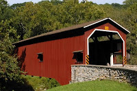
We slept much later than usual. It had to be a combination of a couple of things. First, we were beat last night and second, the site we have at Western Village RV Park is under a lovely canopy of trees so it stays a shaded (overcast) level of light all day. Then, we had a leisurely breakfast and spent some time pouring over the 4 maps of the area we have. The plan was to drive over to Lancaster County and photograph some of the 30 bridges in that part of the state. Before we left NH I had bookmarked a website with 5 driving routes to help us enjoy the countryside, experience some of the Amish charm, sample bits of the local fare and get those photos I’ve been thinking of for a long time. So, I’m wondering why I didn’t print these directions out. After using Carl’s planning skills one more time, we roughed out directions to Lititz which is where the starting point of one of the driving tours began. We hoped the Visitor’s Center would either have the printed directions or would be able to print them for us. In fact, they couldn’t help with anything other than to give me a printed list of the bridges with their GPS coordinates. Armed with another map, Carl plotted a route to 4 bridges and I wrote the directions out longhand. So, off we went and found the first bridge with no problems, the second one proved a bit more elusive and we got lost looking for the third one. The map wasn’t proving as helpful as we thought. Not all roads were represented and others didn’t exist. We were told to go to the end of Farmersville Road and turn left onto Gristmill but when we got to the end the road was Sykes. We accidentally found a bridge we hadn’t been looking for. The day trip fell into a rhythm. I would jump out take the photos of the bridge and whatever else was in the area while Carl sat in the truck and plotted what he hoped would be our next move. Then we’d drive to the next destination, miss a road or find the road wasn’t there and then I’d have to set the camera down and try to figure out where we were on the map. It was all very frustrating. By the third time we were “not quite aware of where we were” , we were pretty frustrated. We found our way back to one of the major routes and the Oregon Dairy Restaurant and Ice Cream Stand for lunch. It was 2:30. After lunch, we set off to try to find one last bridge. It was on the edge of a campground on Red Run Road and was in really bad shape. It was twisted, closed off at both ends, missing side boards and wasn’t over any water that I could see. I passed on this one. Carl worked out how to get back to our RV Park and we immediately couldn’t find one of the roads. After another frustrating few minutes, the highway was in sight and we discovered we were 20 miles further away from the camper than we thought. Once more, poor Carl was beat. He fell asleep sitting up during the first couple of innings of the Red Sox Yankees game. No supper for either of us tonight. The photos we took today were not bad. We did see the classic horse and buggy trotting down the road. After 5 bridges, I realized they all look alike and that’s because they are all Burr Arch Truss construction and built by the same type of craftsmen. Today’s travels took us through Lititz, Manheim, Brownstown, Farmersville, New Holland, Goodville and Blue Ball. Perhaps, tomorrow will reveal a different type of bridge in the Strasburg area.

Monday, August 29, 2011

Day 75- Pennsylvania Campground

The last push was, thankfully, uneventful. We shot through the last hundred miles of Ohio, slipped into a tiny section of West Virginia for some gas and finally hit Pennsylvania where we ran into rough roads, short sections of construction and lots of highway traffic. By 3:30, we were still about 70 miles away from the Western Village RV Park in Carlisle, PA so I gave them a call to advise them of our location. They hadn’t taken a credit card number to hold the site and would only hold our site until 6:00. That gave us plenty of time to get there. In fact, we made it there, got the camper backed into our site and leveled by 6. But after this 2,000 mile push from Moab to Carlisle, Carl was spent and I was also feeling the effects. I still haven’t driven more than 15 feet with the camper so all 12,000 miles plus belong to Carl. That could have some bearing on how he felt. Me, I’m just frustrated because my photos over the past 5 days have been from the passenger seat of the truck at 60 mph. And you have to remember I still have those two “bullet hole” rock chips in my line of sight through the windshield and by the time I focus out the side window, what I wanted to get a photo of is long gone. We didn’t even have the oomph to grill our steak for supper. We opted for a couple of quick microwave frozen dinners. And with no baseball, it was lights out fairly early.

Sunday, August 28, 2011

Day 74- Oh! Is For Ohio

Last night was awful. Before I shut off the lights, there was only one tractor trailer in the rest area with us. But, by the time I climbed into bed, there were about 50, including one who pulled up right beside our open windows. And even though it was still uncomfortably warm, the exhaust was blowing right into our camper so I had to close the windows. The trucker let his truck idle all night long and before morning, another truck had pulled up on our other side just not quite as close. All that noise kept both Carl and me from getting the rest we needed to push on in good spirits today. For the first time, I was concerned we might not make the 400 + miles Carl had set as our goal during this push from Moab, UT to Gettysburg, PA. But push we did and continued on through the last of Illinois and into Indiana. I have to confess I don’t know much about Indiana. In fact, other than hosting a couple of very important races every year and my favorite NASCAR driver, Tony Stewart, claims Rushville as his home town, the only other trivia I can recall is Larry Byrd lives in French Lick, Indiana. So, today, I was enlightened with the knowledge that Indiana also claims Abraham Lincoln as one of it’s own. Apparently, Abe lived here as a child. But, as far as the scenery is concerned, if it weren’t for the big sign welcoming me to Indiana, I couldn’t tell it apart from the section of Illinois we drove through. Rte I-70, surprisingly, cuts through some really nice agricultural countryside in several states. So, if you take photos of fields of corn in Illinois, well, Indiana corn and Ohio corn for that matter, looks about the same. What I’m trying to say is I had a photo drought today. I did discover part of I-70 has been dedicated at the USS Indianapolis Memorial highway. For those of you who do not know the story of the Indianapolis, it was the aircraft carrier that was responsible for delivering the atom bombs to Tinian which helped to end World War II. It was such a secret mission no one missed them until they were 4 days over due. The ship had been torpedoed and sunk, putting almost a thousand men into shark infested water. Only a few hundred were pulled out almost a week later. The story was first brought to light in the original movie, Jaws, but since then it’s been the subject of several documentaries. We’ve been traveling some pretty rough roads all day, some just as bad as the Alaska Highway while others were giving Wisconsin’s pot holes and washboard concrete a run for it’s money. And to top it off, yesterday’s encounter with Jon El’s BBQ had an unfortunate side effect on me today so I asked Carl to pull over so I could use our traveling rest room. When I got into the camper, I was met with a minor disaster. One of those nasty dipsy doodles had tossed everything in the bathroom about, stuff in the sink and all of the recyclable bottles and cans had been thrown onto the floor plus a brand new gallon plastic jug of water had ruptured and emptied onto the floor. The water had run the entire length of the camper soaking the carpeting and rugs by the sink and door. We had a small dry braided garlic hanging over the bathroom door, a gift from Dad and Adena, was also on the floor. Sadly, it wasn’t dry any more and now the camper reeks of garlic. Let’s just say I won’t be getting any visits from my Twilight favorites any time soon. Carl’s goal of reaching the other side of Columbus came one step closer when we drove under this huge arch welcoming us to Ohio and another sign a bit later stating we had just entered Clark County, the birthplace of 4-H. Now, in Ohio, they must take their pipe smoking rather seriously because at one of the convenience stores where we got gas today, they sold 5 blends in 4 different size plastic bags with a press and seal closure. The flavor that got my attention was a generic version of Paladin Black Cherry in a 16 ounce bag. Our final destination was a rest stop about 50 miles east of Columbus but after our troubles last night, we were a bit leery of a second night with little sleep, we opted for a Wal-Mart near the highway. It’s been a while since we’ve stayed in one.

Saturday, August 27, 2011

Day 73- Who Knows Where We’ll Be Tonight

Neither of us had a particularly restful night. It was about 100 in the part of Kansas we stopped in and to top it off, we had been seeing beautiful rest areas with shady picnic and RV parking loops all day. But, when it came time to stop for the night, the rest area we had in front of us didn’t include the shady loop. We set up in the parking area and climbed into the 100 degree camper. I opened ever window possible and we both set there and sweat. The temperature dropped about 20 degrees when the sun set but it was nearly impossible to get the cooler air into the camper. Our Air conditioner remains unusable because of ongoing problems with the generator. I did have wireless internet but it was slow and very frustrating. By the time I edited the photos from yesterday and got them uploaded to face book, I was pooped and climbed into bed. But just before I did, I made myself a cup of coffee and put it in the frig for the morning. That backfired because there was a sediment in the bottom and as we bounced down the road, it got stirred up and was really bitter. Carl made a joke about Dunkin Donuts and I countered with they were only in New England and some parts of Florida. We were both taken by surprise when we pulled into the service plaza to find a Dunkin Donuts there offering my favorite iced coffee. This was also the very first service plaza I’ve been in that offered a storm shelter for it’s patrons. Did I mention we were just outside of Lawrence, KS, the geographical center of the contiguous 48 states. It’s also reported to be the headquarters for a very large array of Intercontinental Ballistic Missile silos which, in the event of a nuclear attack, would make it a primary objective. I didn’t see any missile complexes and I didn’t see any signs pointing me in their direction but I guess they wouldn’t be very secret if that were the case. Is Kansas City, KS and Kansas City, MO the only two like named cities split by a state line? Niagara Falls, NY and Niagara Falls, ON come to mind but half of that is Canada. Somewhere near noon time, we needed to get more gas for the next leg of the trip. Carl pulled into a Dairy Queen / gas station and Carl asked if I wanted to stop. We had both been holding out for either Kansas City or Missouri BBQ so I opted to hold off a bit longer. Can you imagine passing up ice cream for ribs? Shortly, I spotted a billboard that boasted Jon El’s BBQ at Exit 103 in Booneville, MO. Now, I have to tell you, I’m not an expert on what makes the best BBQ but I do know what I like. And, I like Jon El’s food, everything about it, in fact. We were greeted as we entered, not rushed to a decision and the food was dished out before our eyes. The serving sizes are huge so Carl and I opted to share a Combo plate of pulled pork and brisket. There were a number of sides to choose from, macaroni and cheese plus baked beans ended up on our plate. A couple slices of bread, double the silverware and a Styrofoam cup of soda rounded it out. At the table were two kinds of sauce, the vinegary spicy blend and the sweet tomato based kind along with a whole roll of paper towels and of course, salt and pepper. We walked away full and thankful to Jon El for spending all that money for the billboard. I’m posting his face book page with a glowing review of food, service and price. In 11 weeks, other than friends and families meals, this was the absolute best food we’ve eaten and we told him so. Oh, and his hours of operation, seven days a week 11:00 AM to 8:00PM or until the food runs out which Jon El says is often. If you are even on I-70 in MO, make sure to get off on exit 103 and stop in for some great BBQ at a reasonable price. The push today was to hit IL and our road took us through St. Louis, MO. I wanted to catch a glimpse and get a photo of the Gateway Arch, the huge shiny monument to the hardy souls who headed west from this very area in large wagon trains with hopes of finding new opportunities beyond the Mississippi. Our directions took us around the bulk of the city so although I caught a far off glimpse of the arch, there was no way I could get a photo. The rest area here in Illinois is quiet, at the moment, although there is the potential for large numbers of trucks before morning. The good news is there is a nice breeze and it’s a bit cooler than last night. Our supper was wild caught Salmon thanks to Carl and fresh beets from Joe’s Gardens in Bellingham, WA.

Friday, August 26, 2011

Day 72- To Topeka, Kansas

Our stay at the truck stop was brief. Carl couldn’t relax enough to fall asleep with all the trucks running. It really was quite loud so we moved. First Carl thought he’d drive to the next rest area but when he went out front where the restaurant was closed, he noticed a couple of buses and campers parked there. That’s where we spent the night. And it was considerably more quiet than it would have been among the 50 or so trucks out back. As we got closer to the Colorado Kansas border, we began to see evidence of corn, lots of corn, which brought out a conversation about the number of varieties of corn there may be very much like the potato. We even posed the question to one another, is it a special breed that produces baby corn or do they just pick it immature. I suspected it was it’s own variety. We must have been in high spirits because the levity continued with guessing why towns were named the way they were or in the case of Bovina, CO, I broke into very bad song, “ Nothing could be finer than to be in Bovina in the morning”. Carl didn’t get it so either I sang badly or he isn’t a fan of that musical genre. Our very first stop in Kansas was at the Visitor Center where we found out overnight parking was welcome at all rest areas which was good news for us. We checked the area out and could see a lovely paved loop away from the road noise with covered picnic tables and fire pits for charcoal cooking. At the end of the parking area, just before rejoining the highway was a dump station to empty your tanks before heading on your way. It was perfect but way too early for us to pull over. Carl estimates we must make 400 miles every day on our push from Moab, UT to Gettysburg, PA. The very nice ladies at the visitor center also told us where I could find sunflowers in an unfenced field with their heads held high. It was a short but productive side trip. I spent about ½ hour in the field shooting and all the while wishing the sun was out. Everything else was perfect, several acres of accessible flowers in all stages of blooming, complete with honey bees and butterflies. On our way back to the highway, we passed a Wal-Mart out in the middle of literal no where in a tiny little out of the way community of Central Brewster, KS. Back on the highway, we were treated to long views of corn which you’d expect in Kansas plus several more large fields of sunflowers but none as nice as what I had been able to roam in freely. What we didn’t expect to learn is that Kansas is called the Wheat state. We didn’t see any wheat but we did see miles of fields that had already been harvested and I suspect those were the wheat fields. Another surprise was the amount of oil wells we saw during today’s travel. And the people of Kansas sure do like their museums. I should have counted the number of signs proclaim thing the way to the Cavalry, Oz, Stover, Zoo and farm machinery museums to just name a few. Carl was only slightly tempted with the Stover factory store while I really was interested in the Cavalry museum. We even passed the Eisenhower Museum and Presidential Library. And there were so many other claims to fame, counting 3 astronauts and many collegiate championships. Fort Riley, home of the Big Red 1 appeared on our left, a couple of miles of sand colored vehicles, tanks and other items needed overseas. Towards the later part of the afternoon, I spotted a beautiful church off in the distance, the sign read St. Fidelis Church, one of the 8 great wonders of Kansas. I can’t wait to discover what the other 7 might be.

Thursday, August 25, 2011

Day 71- From The Desert To The Mountains

Two states, Utah and Colorado share a border and a river but similarities, at least for the beginning of the day , ended there. Once we left Moab and got onto Rte I-70 East, the land flattened out into those rolling dry plains like so much of the Southwest is made up of. I made a comment to Carl how there was a good looking hunk of a young man behind every tree. Of course, there wasn’t anything larger than a 3 ft tall bush in site. What I was seeing, however, were these metal step ladders placed over the 4 strand barbed wire fences every mile or so. At first, I thought this was strange but the more I thought about it, the more it made sense. I mean 4 strands of barbed wire is nasty business so if you need to get over to the other side, well there are limited options. Farmers and ranchers tend to frown on cut fences and people in need are not happy about getting clothing and skin shredded to bits. Shortly after crossing into Colorado, we began to notice several of those rocker arm pumps bringing oil to the surface. Wherever these are, there are also a collection of tanks and sometimes a little tool shed. One of these had a red light glowing by the door and we couldn’t help but laugh. Customers would be few and far between in that district. Those gently rolling plains became high sandstone mesas with huge skree piles on all sides. Off in the distance we could see what I considered to be serious mountains. And sure enough, we began to climb gradually at first. We pulled off in Rifle, CO for some gas. I mention this because the guy I used to work with, Ernie, lived in Colorado for a while and Rifle, specifically. The mountains loomed closer and ski are signs with names like Copper, Steamboat Springs and Breckenridge popped up. Now, we’ve become somewhat of a whiz in finding Wal-Marts. Call it a second sense if you will. But, here in the Vail area, we didn’t have a clue. When all of a sudden, on the highways signs that point out services such as gas, food and lodging, there was the familiar bright blue Wal-Mart name and logo so we turned and sure enough there it was only ¼ mile off the highway. We pulled in to get the few provisions we needed to take us to Gettysburg, PA. We had no intentions of staying the night but wouldn’t have been able to anyway. We had just encountered our 2nd “No Camping or Overnight Parking Allowed” store. After a 45 minute break, we hit the road once more and began seeing signs about a 3 day Bike Race in the area which list traffic restrictions, road and exit closures and parking bans through Vail Pass. I’ve since found out it’s the USA Pro Cycling Challenge. As we drove, we caught glimpses of support vehicles laden with spare bikes, riders peddling like crazy, motorcycle escorts, a helicopter for aerial coverage, the banners over the course announcing the near finish of the race and finally the finish line. There were thousands of spectators strung out over miles. We figured the winner of the stage had already come in because hundreds of amateur cyclists were leaving the area including one tall lanky fellow who I could have sworn was Lance Armstrong ( not racing, watching ). Did I mention during this whole exciting bit, we were still climbing only now it was much steeper. Most of the tractor-trailers were down to 50 mph and so were we. Finally, we leveled off just before entering the Johnson Tunnel, finished in 1979, at 11,158 ft above sea level. As we came down the other side of the Rockies, I looked down to see chairlifts below us. You know you’re up high when you look down on ski lifts. And as much as I enjoyed the desert with all of the impressive multihued rocks and weird weather and water worn shapes, I just love seeing full sized forests all over the place. After a time, we reached Denver and wouldn’t you know, it was just 5:00 PM, rush hour. The west bound lane seemed backed up in real good order so I was feeling pretty good about our east bound lane which was still moving steadily. Carl mentioned it might change when we hit the middle of the city with people leaving and sure enough, not 2 miles later, traffic slowed to a crawl. There was an accident up ahead. We hit the choke point in time to see a car being loaded onto a tow truck. The front end was smashed pretty good. That was in the high speed lane while in the breakdown lane was a utility trailer just sitting. It looked undamaged except attached to the ball hitch area was an entire Reese Hitch system, the receiver portion having been ripped off whatever vehicle it had been attached to. After we passed this exit, traffic resumed it’s normal pace and we were out of the city about 15 minutes later. Clear of the city, the landscape was now more agricultural and grazing lands. The were small farms or ranches on the horizon, but there were also quite a few abandoned homes and falling down barns near the highway. Anytime you have grazing lands, there is the probability of grazing animals so I wasn’t surprised to see large herds of beef cattle and saddle horses. I mentioned to Carl how strange it was to have such a drastic swing in just 40 miles. It was nearing the end of the day and we started looking for a rest area. We found one which was closed to overnight parking and another in the west bound lane so after driving an additional 45 miles, we pulled into a Flying J Truck Center along with about 50 big rigs. Our little camper is backed in next to a “no parking” zone where trash barrels are. That way, we take up only one spot and can still open the slider without getting into any of the truckers’ ways. Space is so tight, Carl doesn’t dare to leave our steps open all the way. It ought to be an interesting night. Yesterday was the end of the 10th week and we have traveled a total of 12,236 miles so far.

Wednesday, August 24, 2011

Day 70- Last Day In Arches

Well, we finally made it. It’s about a mile into Landscape Arch but I have to tell you, most of the way was in the shade because it was so early in the morning. And, it was well worth the effort. I mean this arch measures 291 feet long and is 118 feet tall. There is a very narrow spot which is less than 6 feet thick. In 1991, people had been sitting under the arch when they heard groaning and little cracking sounds. They moved out of the way just before a huge piece of the arch fell. Someone caught the break on their video camera. We saw the footage and I have to tell you, as I have always said there are three elements to a great photo, right place, right time and have camera. Man, they had it all! We spent some time at the end of the trail just soaking in the marvel of it. It is the largest arch in the park and may be the longest natural span in the world. On the way out we visited Pine Tree Arch and Tunnel Arch. Then we moved to Sand Dune Arch. By then the sun had climbed higher and we were starting to feel the heat. We went to breakfast at Denny’s in Moab where Carl tried to get me a free birthday meal the day after my birthday. It was a good try but our server had to stick to the rules. Then it was back to the camper for showers, laundry and I also put together a crock pot lasagna. If you think it sounds like we’re getting ready to roll, you’re right. We’ll head to Denver, Co in the morning on Rte I-70 and stay on that road all the way to Gettysburg. After supper, we were back in the park. I had a score to settle with the Windows and some bad lighting. This late afternoon light was much better and there were far fewer people getting into the arches and in my way. Then Carl and I headed around the back side of the window arches. The trail, considered primitive, was a little challenging in places but it was all shade which was a great thing. All together, we walked about 4 miles today and the high for the day was 101. Unfortunately, we missed the sunset because we were out of position when it got to the colorful stage. It’s really hard to judge the rate of descent when there are solid sandstone cliffs a couple hundred feet high in your west facing vision. So, now, I have to tell you I don’t know when I’ll have internet again. But, I’ll keep blogging and taking picture and will catch you up at the next hot spot.

Tuesday, August 23, 2011

Day 69- Change Of Plans

Well, plans change quickly with us. The alarm went off and I could hardly get out of bed to shut it off. I suspected after my fall yesterday, I might be sore but I wasn’t prepared for the stabbing pain that shot through my shoulder and back. Back into bed I tumbled and Carl and I slept until a little after 7. After breakfast I got caught up on posting some photos, through some boneless ribs into the crock pot for a meal later in the week and did laundry. Now, we’re trying to salvage the day. We have the rest of today and all of tomorrow to cram in as much as we can before hitting the road on Rte I-70 all the way to Gettysburg, PA. We decided a drive along Rte 128 which winds along the banks of the Colorado river would be a nice alternative. It was a good decision. The countryside we drove through was spectacular and the drive gave us many miles of pleasure, including watching river float trips go by as well as checking out the Bureau of Land Management campsites along the way. We even took a few moments to stop at the Castle Creek Winery to sample the fruits of their labors. The exceptionally pleasant lady could pour three samples for each of us and we could share so we got to taste 5 different wines and had a second sample of one other one before we made up our minds to purchase two bottles. Later in the evening, it was the Moab Brewery for supper and to sample the best beer Moab has to offer. In fact, the Moab Brewery is the only microbrewery in Utah. Carl had 3 samples before making his mind up on which one he would have in a “grown up size”. And to finish off the day, we went to the movies to see “Rise Of The Planet Of The Apes”, a movie heavy in special effects but good ones. Andy Sirkus , Golem in the Lord Of The Rings trilogy, plays the lead and it’s the first movie Carl and I have ever seen where the “animal actors” got top billing over the “human” actors. We’re back on schedule for an early morning visit to the park. The alarm is set.

Day 68 - The Weather Jonahs!, August 22, 2011

We’ve decided that we are weather jinxes. It seems as if we are in that Peanuts cartoon where the cloud and rain follow that one poor little guy all over. And so it is with us. I never thought about rain in the desert until the past three nights. Tomorrow, I’ll take the umbrella. But tonight, we went to Dead Horse State Park. The name is derived from a legend. In the 1800’s a group of cowboys drove wild horses out to the high mesa surrounded by a 2,000 foot drop to the Colorado River save this one 30 yard opening. After selecting the horses they want, they left the brushwood fence up abandoning the horses to a terrible death by thirst, being able to smell the river below. Now, if there is any truth to this legend, it must have been horrific. We were there during a brief rain storm. Puddles formed and then disappeared as if someone had sucked them up with a wet dry vacuum. And even the rocks were warm and dry only twenty minutes later. The view down was spectacular, especially when the sun hit the mesas and canyon far below. In this part of the Colorado’s 1450 mile journey, the water was jade green at Horseshoe Bend and moving quite slowly. We spent lots of time waiting for the sun to reappear but when it did, it made a world of difference making the colors of the rock layers just pop. This part of Canyonlands is mostly stepped mesas with a couple of dramatic spires. Carl has decided not to visit Canyonlands as there is more than enough to keep us busy at Arches. So, in the morning, we’re off to Landscape Arch, the thinnest and longest of the arches in the park. We just won’t be there quite so early.

Monday, August 22, 2011

Day 68 - The Weather Jonahs!

We’ve decided that we are weather jinxes. It seems as if we are in that Peanuts cartoon where the cloud and rain follow that one poor little guy all over. And so it seems with us. I never thought about rain in the desert until the past three nights. Tomorrow, I’ll take the umbrella. But tonight, we went to Dead Horse State Park. The name is derived from a legend. In the 1800’s a group of cowboys drove wild horses out to the high mesa surrounded by a 2,000 foot drop to the Colorado River save this one 30 yard opening. After selecting the horses they want, they left the brushwood fence up abandoning the horses to a terrible death by thirst, being able to smell the river below. Now, if there is any truth to this legend, it must have been horrific. We were there during a brief rain storm. Puddles formed and then disappeared as if someone had sucked them up with a wet dry vacuum. And even the rocks were warm and dry only twenty minutes later. The view down was spectacular, especially when the sun hit the mesas and canyon far below. In this part of the Colorado’s 1450 mile journey, the water was jade green at Horseshoe Bend and moving quite slowly. We spent lots of time waiting for the sun to reappear but when it did, it made a world of difference making the colors of the rock layers just pop. This part of Canyonlands is mostly stepped mesas with a couple of dramatic spires. Carl has decided not to visit Canyonlands as there is more than enough to keep us busy at Arches. So, in the morning, we’re off to Landscape Arch, the thinnest and longest of the arches in the park. We just won’t be there quite so early.

Day 68 - Rise and Shine , August 22, 2011

When the alarm went off, Carl announced, “It’s your mother!” I knew better. We each made a morning beverage, threw a couple bananas and granola bars in the sack and hit the road with flashlights in hand. We didn’t encounter a soul on our way into the park. The parking area was completely empty at Double Arch so armed with our flashlights, we hit the easy trail in. Then it was a waiting game. Waiting on the sun, that is. Now, I understand the difference between early morning shots and sunrise shots. Double Arch is NOT a sunrise shot. We stayed over three hours until the sun had advanced on the rock as much as we felt it was going to because there was a high band of puffy whites that appeared to be growing thicker. We had enough time there to be on first name basis with a couple of crows, a flock of swallows and a very small squirrel. I think we also began to give names to the surrounding rocks. Thankfully, two couples from San Francisco came along to relieve our tedium. They waited with us for more than an hour. And then it was time to move on. Carl felt like heading for “home” and breakfast while I thought I was up for another short jaunt into Turret and The Windows. Well, Turret was spectacular but unfortunately we were in the wrong position for North Window because I was shooting into the sun and there was a steady stream of people getting into my shot. The South Window is less accessible for people to climb into so that shot was a bit better. This is a late afternoon shot for sure. We caught up with the two couples from Frisco again and I made a joke just in time for them to see me fall on my face. Yup, my knee didn’t work and down I went. It’s my first fall in almost 10 weeks but it’s the very first time I’ve fallen where I’ve been unable to keep the camera from hitting the ground. I felt miserable about the whole thing. Everyone tried keeping me still to make sure I was all right and I kept asking Carl to get the camera, to make sure it was still working and then and only then, would I get up off the ground. It was 10:00AM and getting hot. I didn’t break anything, the camera is still working and I’ll take it easy for the rest of the day.

Sunday, August 21, 2011

Day 67- Arches National Park , August 21, 2011

There is no way to describe the incredible works of nature before my eyes. It’s hard to believe this area was all under water a couple hundred million years ago. Eventually, with upheaval, rain, wind and time, these breathtaking formations were created. It’s a very slow process, even by geological time. My photos are poor substitutes for the grandeur in front of my lens. We slept too late to get out and tear into the park so we ended up doing exactly what I had said I wouldn’t do, hike in the park between the hours of 10 and 2 when the sun is the strongest. By the time we took care of a little bookkeeping error on the part of a Yellowstone Ranger, it was almost 11. We drove in, stopped at a few places on the way, the Three Gossips, Sheep Mountain, Balanced Rock, The Windows and then we arrived at Delicate Arch. We hiked into the viewpoint at high noon and by the time we got ¾ of the way up, I was toast so Carl took the camera and went the additional distance. When he returned, he said it was only another 200 yards or so. I was really angry with myself for not pushing further especially when I saw the photos he took. It’s his picture attached to this blog entry. It’s a good thing we have three more days, in the park. I want to be at some of the more famous arches at the right time of day. This is going to mean hiking in before daylight or hiking out after the sun has set. We went back into the park sometime after 6:00 PM. My time is vague because we had a sudden thunderstorm which delayed my decision on where to go, when to go and even if to go. We got some nice late afternoon sun on the Courthouse Towers but by the time we made it to Balanced rock, the sun was obscured behind a wide band of very dark clouds. We waited about ½ hour and then it happened. The sun broke trough for one glorious finale, splashing that gorgeous afternoon light just where I needed it. The down side to this was I used up all our time before sunset and I was out of position. Carl always has some good ideas so up onto a high layer of racks we went to find something interesting in the foreground of whatever sunset we were blessed with. Sadly, the day was spent and so was I. we ate our supper sandwiches right where we parked as the last rays of light faded. The alarm was set for 5:00AM with a decision made to go to Double Arch for sunrise.

Saturday, August 20, 2011

Day 66- Salt Lake or Bust

The road through Idaho was more or less uneventful so we started guessing what sorts of crops we passed. I thought I spotted Beets and Alfalfa but was delighted when my eyes picked out the now infamous Idaho Potato plants with their tell tale mounding of soil around them to stimulate more tubers. We did have two final impressions of Idaho. One was of a burned out car on the westbound brake down lane. That in itself should be noteworthy for I can’t see the highway department leaving an immobile hulk there for very long. It was the man sitting on the edge of the grill that caught both Carl’s and my attention. We were past it so quickly I couldn’t get a shot and since my mind was already on “did this just happen” or “where’s the rest of his belongings” and I think I even thought “where did the engine go” ? If not for the camper, I just know Carl and I would have turned around at the next exit to backtrack for the photo. Oh, well, you can’t have everything. I’ve gotten used to having the traveling bathroom with us. Sadly, the last impression of Idaho was two bad experiences with rest area toilets. The one in Twin Falls was so bad you felt you needed to wash your hand before you used it. Carl said, “It’s like they schedule a cleaning once a year and tomorrow’s it” . And the one after that was also bad. The ladies side reeked of chlorine to the point of burning my eyes and Carl said the urinal had no water running to it. Just before the Utah border we came upon an unnerving sight. In the meridian, facing the wrong way and almost into the east bound lane was a truck and travel trailer. It appeared to us, they were traveling west bound, perhaps passing another vehicle and caught the soft shoulder. What we couldn’t see was if a blowout was involved. We do know both people in the truck were out and walking around, shook up, I’m sure. And a few minutes later, we saw police responding to the scene. We hadn’t been in Utah very long before we saw our first pronghorns. Remember, they are not antelope as most people say. We learned that in Yellowstone. These were noteworthy because the small herd was grazing just a couple hundred feet from an irrigation line. I sure hope the farmer is a tolerant man. A visit to the Visitor Center got us information about Moab and a couple of other things to do besides visiting Arches National Park. He suggested a side trip to Antelope Island which is in the Great Salt Lake. I thought that would be a nice diversion and I could get photos of the lake while we were there but Carl didn’t see the value in the stop. Unbeknown to me, he had a plan to drive through Salt Lake City before rush hour so my impressions of this huge and sprawling city are just that. It’s huge and sprawling. There are gated communities where the church is built first and then the houses are built around it, much like in early settler times ( minus the gates, of course ) because the church was the center of all activities. I spotted a huge domed building which I made the assumption was the capitol building and I caught a glimpse of the Great Mormon Tabernacle high up a contour overlooking the city. Carl asked if that’s where “The Choir” sang and I had to admit I could only guess the answer was yes. One of more annoying novelties of our trip has been billboard watching. Since New Hampshire outlawed them on our few hundred miles of high speed roads, I don’t miss them. In our travels, they have been prevalent in many states. Carl spotted this one and we both laughed. The words “Eat More Chicken” were scrawled across the board. The last “n” had a paintbrush sticking out from it with a 3 dimensional Holstein cow trying to balance on the shoulders of another cow who was on a ladder. The whole affect was quite amusing to think cows would be suggesting another alternative. What most people probably missed from this cut little tableau was Holsteins are milking cows and not beef animals. I’m sure they used the characteristic black and white spots which most people use to illustrate the “cow idea”. I mentioned Salt Lake City is huge and sprawling. What I didn’t tell you was the temperature was low 90’s and I had been pushing the fluids. We were more than an hour into the cross town travel when I had to go. I waited, hoping to get out of the city so Carl could pull over easily but the city just kept on going and so did we. Eventually, it got too much for me and I had to ask him to get off the highway so I could go. The very next exit was a Wal-Mart so we took that opportunity to get the rest of our groceries for our desert stay and I went to the bathroom not once but twice. And then, the most amazing thing happened. Off in the distance, the sky looked ominous, clouds were building against the mountains and I could see wisps of rain falling. We’re in the desert and it’s raining. But, it was the lightening that grabbed my attention. I set out to capture it on film, no easy task in a moving vehicle I might add. After about 50 shots, I managed one photo and I’m very proud of it. As we moved closer to Moab, the landscape became way more impressive with tall pinnacles and huge cliffs of multicolored sedimentary rock, some heaved up at an angle from all the tectonic movement. The finish to the day was a gorgeous rainbow falling against an equally hued rock butte and a sunset like nothing I’ve seen during the 10 weeks we’ve been on the road. I grabbed a shot in the rear view mirror but Carl was the one who made the decision to stop on the side of the road and told me to get out and take the photo. It was well worth the few minutes we were delayed. I love that man!!!! We saw lots of flashing lights ahead of us and had to slow down for single lane traffic. A police officer was doing his best to be seen in the pitch black and controlling the traffic flow past an unrecognizable large object, perhaps a motor home or a tractor trailer, that was burnt on the side of the road. The emergency response people were still on scene pouring water on the skeletal remains of the vehicle. It certainly put a damper on the last 15 miles we had to travel to the Arch View RV Park. We almost missed it but Carl remembered the lady on the phone mentioning a Shell gas station.

Friday, August 19, 2011

Day 65- Tonight We Slept In Bliss

Now before you jump to all those sexually explicit ideas, I should probably explain and I will get to that, eventually. As you recall, lat night we were in WA state at a Wal-Mart which, by the way, was a great place. After doing our usual morning chores and getting gas we were headed down Rte I-82 and a few miles later, we were on Rte I-84, our designed route for the day. Along with all of the fields growing, being harvested or resting, there were some that looked burnt. And as it would happen, we saw smoke off in the distance. We’ve found the ranchers and farmers both will allow fire to help enrich the land along with water and/or fertilizer. It was easy to see the patchwork quilt this created because the land was so flat for mile after mile. Off in the distance was Oregon but before we could get there we would climb gradually more than 4,000 feet. Once at the top, there was a pull off to allow us to take in the valley and the view that sprawled out before us. The temperature in WA was due to be in the 90 degree vicinity and it will only get warmer the further south we go. While at a Visitor Center in Oregon, I confirmed the reason behind the dry desert like area we were driving through and just as I suspected, it’s the same reason that WA state has a lush green north western side and a much drier south eastern side. It’s the rain shadow cast by the Cascade Mountains. The mountains act as a huge barrier holding the clouds on the Pacific side so most of the rain stays there. In due course we found ourselves back among the evergreens with the land around us taking a much hillier attitude. We stopped for fuel and lunch in Baker City before heading off for Idaho. We’ve been having these multi grain Ciabata rolls purchased at Wal-Mart as the base for our sandwiches. They have great substance but are on the softer side. The skies remain virtually cloudless as we travel past huge ranches and tiny farms. In one of these little fenced in pastures were several head of cattle but the one who caught my eye had immense horns. Carl made a joke about these being Oregon Longhorns while I proposed the possibility , just for argument’s sake, this longhorn may in fact be from Texas and he’s visiting is relatives in Oregon. The steer wasn’t talking so we continued with our travels eastbound. A tractor trailer went by with this immense white item strapped to a flatbed. It sort of liked like a giant Nike swoosh. Carl got it right away. This was a replacement blade for one of the many wind generators we have passed today. About 20 minutes behind the first truck came a second. Logic would dictate a third should be along shortly but while I had camera in hand, it didn’t show up. Carl has put out the premise, again for consideration, the wind farms creates the wind he fights when he drives through these areas. He isn’t ready to admit the wind generators are here because of the steady and sometimes strong winds whistling across the open plains. Personally, I think he knows but just wants to try to get me started. Just before we cross the river into Idaho I spot a huge manufacturing plant. The sign on the building reads Ore-Ida and although I’ve purchased this brand of French, Curly, Steak and Shoestring fries for years, it just now hit me where the name came from. The aforementioned river behind us, Idaho’s countryside awaits us. Ever notice how you will often cross a river from one state to another? It seems as if these waterways are natural boundaries. This was pointed out in a show we watched often called “How The States Got Their Shapes”. Somewhere along the highway I’ve spotted a sign which announced our return to Mountain Time loosing another hour which makes us only two hours earlier than home now. What this really means is I get to listen to the Red Sox game earlier than Dylan and thankfully, we are no longer in the latitudes where the horizon interferes with the satellite. The visitor center in Idaho has an historical information sign which tells of an Indian gather on this very spot where all of the tribes would bring what they had an abundance of to trade with others for what they needed. This gathering was called the Salmon Festival. It mentioned the trading of not only fish but horses, teepee poles, herbs, baskets, buffalo meat and hides. I surmise the name comes more from the time of year the swap meet happened, when the salmon swim upstream. Carl has another one of those days where he’s not ready to stop when we reach Boise so he decided to keep driving another couple of hours. There’s one last curious item to mention before I wrap this up. It’s about onions or more precisely the aroma of onions that is so strong inside the truck as we drive we are baffled. On either side of us were miles of cow corn and wheat but I didn’t see any onions growing. The odor lasted a few miles and then vanished. By now, you trying to figure out the title of this entry which could have just as easily been “3 States In One Day”. Well you don’t have to wait any longer. The pull out Carl decided to stop at for the night is called the Bliss rest Area. As it happens, we are about 5 miles from the town of Bliss but it will do. There is a clear view of the western sky but so few clouds, I have little hope for sunset photos. I can see another bank of wind generators in the distance and while I was eating supper, an enormously long freight train passed behind the giant three armed beasts. Who knows where we’ll stop tomorrow. It’s supposed to be Salt Lake City but it’s anyone’s guess.